Getting Started with the Territory Management App
Galigeo for Salesforce Advanced allows you to manage your sales territories :
- Analyze Territories based on Salesforce metrics
- Redesign Territories based on standard or custom geounits
- Re-assign records following sales organizational changes
Definitions
You will encounter the following terms in the documentation:
Territory
A territory is a geographical area containing a set of sectors. A territory can be assigned to a stakeholder.
Sector
A sector is a small geographical entity. It is the building stone of a territory. A Territory Design project is based on a layer of sectors, i.e. a contiguous set of sectors. Here are some examples of sector layers: the commons or the IRIS indicators in France, the zip codes or the counties in the US, etc.
Stakeholder
A stakeholder, in the sense of Territory Management, is a physical person or an entity who can be assigned to a territory. The representatives are defined by the application administrator.
User Interface
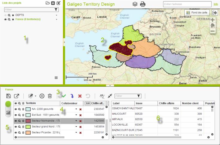
The general interface looks like in the figure bellow with:
- Projects
- Map view
- Toolbar
- Territory view (table view or graph)
- Button for toggling the type of view
- Sectors view

The green vertical bar, placed between the two tables, modifies the size of the territory and sector view.
The horizontal bar allows to resize the application, or to hide it if the button in the middle of it is pressed.
Steps
- Create a project
- Design territories and assign them to stakeholders
- Mass assign records to Salesforce users